In Puglia you walk on three different route systems: the Via Francigena del Sud, which in Puglia alone covers 878 kilometres in 42 stages, the Cammino Materano with its seven routes, and the Cammino del Salento. Not all of them can be walked: some routes are closed, and this page says which. The right season is autumn and spring: in Puglia you walk when you are not at the beach. And we give the height gain for the stages, the figure almost nobody publishes and the only one that tells you what a day will really cost your legs.
Three walking routes, not one
Puglia is four hundred kilometres long and narrow, and for centuries it was the last strip of land before setting sail for the East: pilgrims bound for the Holy Land, crusaders, merchants. The long-distance walking routes that cross it today, known in Italian as cammini, follow those old roads. There are three separate systems, which meet but never merge.
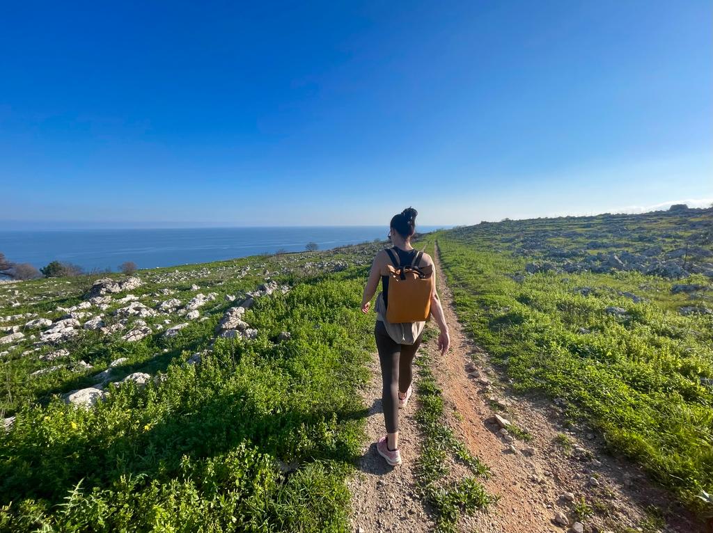
The first is the Via Francigena del Sud, the southern continuation of the pilgrim road that starts in Canterbury: it enters Puglia from the Daunian Mountains and ends at Santa Maria di Leuca, where Italy runs out. The second is the Cammino Materano, a fan of seven routes that all converge on Matera, arriving from Bari, from Brindisi, from Manduria and from Trani. The third is the Cammino del Salento, which runs from Lecce down to Leuca.
The thing that confuses everyone, so let us say it straight away. From Lecce to Santa Maria di Leuca there are two different walking routes, not one. The Via Francigena del Sud goes through Martano, Otranto, Vignacastrisi and Tricase in five stages. The Cammino del Salento, on its Via del Mare, goes through Roca Vecchia, Torre dell’Orso, Otranto, Santa Cesarea, Castro and Marina Serra in seven. They start from the same place, touch at Otranto and arrive at the same sanctuary, but in between they are two different roads, with two different sets of waymarks and two different pilgrim credentials. Mix them up and you will find yourself looking for arrows that are not there.
How much walking there is, in numbers
We measured every stage of the Via Francigena one by one, starting from the GPS tracks published by the European Association of the Via Francigena Ways, the body that manages the route for the Council of Europe. These are our own figures, and behind each one there is a real track.
- 878 kilometres of Via Francigena in Puglia.
- 42 stages, on four branches.
- 9,917 metres of climbing in total.
- 3 separate walking route systems.
The four branches of the Francigena in Puglia are the main route (554 km, from the Daunian Mountains to Leuca), the Coastal variant that runs down the Adriatic from Monte Sant’Angelo to Bari (144 km), the Micaelica variant that climbs to the sanctuary of the Archangel Michael (114 km), and the Bradanica variant, which crosses almost at once into Basilicata and has only three stages in Puglia.
What you can actually walk right now
This is the question that matters more than any other, and the answer changes from year to year. Some routes are fully waymarked and have places to sleep; others exist on paper but not yet on the ground; one is closed for works.
- Open and waymarked: the main route of the Via Francigena, the Via Peuceta and the Via Ellenica of the Cammino Materano, and the Via del Mare of the Cammino del Salento.
- Open, but walk it with the GPS track: the Ellenica variant between Brindisi and Alberobello, where the association itself says the waymarking is poor in several sections.
- Closed: the Via dei Borghi of the Cammino del Salento, closed for 2026 while it awaits a relaunch, and the Sveva and Dauna routes of the Cammino Materano, still being set up.
Why we say so, instead of listing everything as if it were ready. A closed route is not a bureaucratic detail: it means no arrows at junctions, nobody maintaining the paths, and places to stay that do not know they are on a route at all. Guides that list seven routes of the Cammino Materano without saying that two cannot be walked send people straight into trouble. Before you set off, the last word always belongs to the official website of the route: the information here was checked in August 2026, but these things change.
When to walk in Puglia
Not in summer. The organisations that run the routes say so themselves: the Cammino Materano recommends spring and autumn for the Via Ellenica, autumn, winter and spring for the Via Peuceta, and autumn to spring for the Via Jonica. From June to September the interior regularly goes above 35 degrees and shade is scarce: olive groves give little of it, and the dry-stone walls none at all.
It is the exact opposite of the beach calendar, and that is good news for travellers: the walking season starts when the beach season ends. From mid-September the days are still long, the towns are livable again and places to stay have rooms free. The month-by-month detail, together with waymarking, credentials and GPS tracks, is in our practical guide to walking in Puglia.
Height gain, the figure that is always missing
Everyone publishes the kilometres. Almost nobody publishes the height gain, which is the difference between a stage you stroll through and one that brings you to your knees. Twenty-seven kilometres on the flat plain of the Tavoliere and twenty kilometres uphill on the Gargano are two days that cannot be compared, and the kilometres alone do not tell you that.
Two examples speak for themselves. The Stignano to San Giovanni Rotondo stage is 20.5 kilometres with 984 metres of climbing, the hardest stage entirely within Puglia. The Monte Sant’Angelo to Manfredonia stage is 13.9 kilometres in which you descend 963 metres, from the sanctuary at 818 metres down to the sea. On paper they are two short stages. On your legs they are nothing of the kind.
Our pages on the single routes give the kilometres and the climbing stage by stage. We did the same for the cycling routes, and for the same reason: to see where the effort lies before you set off, not halfway through.
What we had already written, and is still useful
Our site has twenty years of writing about these places, much of it from before the walking routes had a name and waymarks. Some of those pieces describe exactly the stretches you walk today, and they are worth reading alongside the route pages.
- The Via Appia: the Roman road that ends in Brindisi. The UNESCO site inscribed in 2024 also includes the Via Traiana, the line followed by much of the Francigena in Puglia.
- Otranto to Santa Maria di Leuca: the final stretch, where the two Salento routes come together again, told stretch by stretch along the coast.
- The Grecia Salentina: the Francigena passes right through it at Martano, and the villages where Griko, an old Greek dialect, is still spoken are what make that stage worth more than thirty kilometres of countryside.
- The Grotta della Poesia and Roca: a short stretch of the Adriatic coast, on the line of the Via del Mare.
- The Gargano between history, faith and nature: six days on the promontory, useful if you want to extend the Micaelica instead of heading straight down to the sea. At the top of the promontory are the ancient beech forests of the Foresta Umbra, a UNESCO site not far from the stages of the Micaelica.
- The Alta Murgia National Park: the Via Peuceta crosses it between Cassano and Altamura.
- The gravine: the ravines the Via Ellenica follows from Massafra to Ginosa, with rock-cut churches and cave villages inside them.
Where to start
- The Via Francigena del Sud in Puglia: the 42 stages measured, the four branches, and the link with the Roman Via Traiana.
- The Cammino Materano: the seven routes, which are open and which are not.
- The Via Micaelica: from Troia to Monte Sant’Angelo, the pilgrim road of the Lombards.
- The Cammino del Salento: the two routes from Lecce to Leuca, the stages and the practical guide.
- Walking in Puglia: when and how: season, waymarking, credentials, GPS tracks.
And if you prefer pedals to walking boots, many of these routes have a cycling version: you will find it in our section on cycling in Puglia. All our routes through the region are collected under Itineraries.