In Puglia you walk from September to May, not in summer: the organisations that run the walking routes say so themselves, and the reason is the heat, not the hills. Here is when to go, how the pilgrim credential and stamps work, where to get the GPS tracks and, the thing most guides leave out, which routes are waymarked and which are not. On a route without arrows the track is not an accessory: it is the only way not to get lost.
The season: the opposite of the beach season
This is the first thing to understand, and it turns most visitors’ idea of Puglia upside down. The walking season starts when the beach season ends, and that is not our opinion: it is what the people who manage the routes write. The Cammino Materano, a network of walking routes leading to Matera, recommends spring and autumn for its Via Ellenica, autumn, winter and spring for the Via Peuceta, and autumn to spring for the Via Jonica.
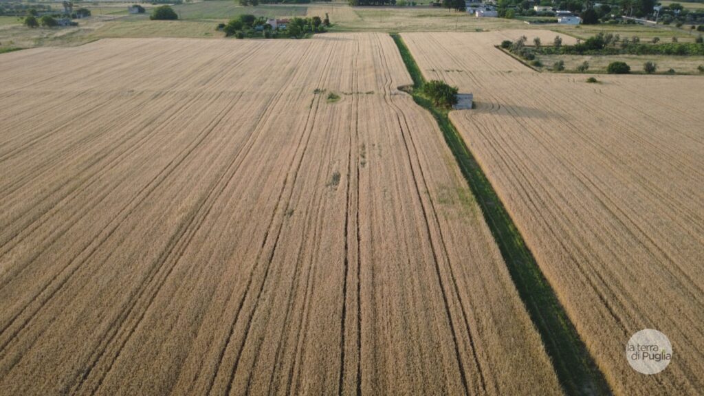
The reason is not effort: Puglia is flat almost everywhere, and the only serious climbs are on the Gargano promontory. The reason is the sun. From June to September the interior regularly goes above 35 degrees and shade is scarce: olive groves give little of it, dry-stone walls none, and on many stages you walk for hours without a single tree.
- Mid-September to November. The best window: days still long, temperatures down, towns back to normal and places to stay with rooms free.
- March to May. The other good window, with the countryside at its best and the days getting longer.
- December to February. Possible on the plains and along the coast, where the climate stays mild; not on the Gargano, where it snows on the high ground.
- June to August. Best avoided. If you must, start very early, keep the stages short and carry plenty of water.
What makes or breaks a trip: the waymarking
Not every walking route in Puglia is marked in the same way, and the difference between a path with arrows and one without is huge. On a waymarked route you walk looking around you; on an unmarked one you walk looking at your phone.
- The Cammino del Salento is marked with orange arrows, and its website still advises always carrying the track with you.
- The Via Ellenica of the Cammino Materano is declared complete, with waymarking and places to stay along the way.
- The Ellenica variant between Brindisi and Alberobello is described by the association itself as a work in progress, with poor waymarking on several stretches: walk it with the GPS track.
- The Sveva and Dauna routes are closed: they have neither waymarking nor a network of places to stay.
GPS tracks: where to get them
Each route distributes its own, and the method varies. The Cammino Materano publishes the tracks for each stage on its website. The Cammino del Salento emails them to anyone who fills in a form, and states the date of the latest update. For the Via Francigena, the old pilgrim road to Rome whose southern stretch crosses Puglia, the reference is the European Association of the Via Francigena Ways, which publishes the routes of every stage.
Two practical precautions apply to all of them: download the map for offline use before you leave, because mobile data is not guaranteed in the countryside, and carry a spare battery, because a GPS running for eight hours uses far more power than you would expect.
- Via Francigena del Sud: the tracks of every stage are on the website of the European Association of the Via Francigena Ways, inside the interactive route map.
- Cammino Materano: the download area of the official site, under “GPX Percorsi”. Check the date: the Via Peuceta tracks published there were last updated on 18 August 2022, those of the Via Lucana in April 2023.
- Cammino del Salento: not a direct download. You fill in a form and the track arrives by email. The site states when it was last updated, which is the right thing to do: as we write, 12 March 2026.
A track that is four years old is not useless, since a route does not move, but a stretch diverted for roadworks or a new variant will not be in it. The signs on the ground always beat the file, and when the two disagree, follow the signs.
Credential, stamps and certificate
All three systems have a pilgrim credential, the walker’s passport familiar from the Camino de Santiago: a document showing you are travelling on foot, which you get stamped along the stages and which gives access to affiliated places to stay. Each route has its own (the Francigena one is not valid on the Cammino Materano, and vice versa) and you request it in advance on the route’s website.
At the end, walkers who have collected the stamps receive a certificate, which the Cammino Materano calls the testimonium. It is not compulsory and has no practical use, but it gives the day a structure and, for many, it is the souvenir that stays.
What to expect from each day
Almost all stages on the Apulian routes are between fifteen and thirty kilometres, with a few short ones and the odd long day: on the Francigena the shortest is Molfetta to Giovinazzo at 8.1 km, the longest Torre Santa Sabina to Brindisi at 34.7. A trained walker covers these distances in five to eight hours, breaks included.
The end of a stage is almost always a town, such as Altamura, Trani or Otranto, and this is one advantage Puglia has over mountain routes: you sleep in the centre, eat well and can find a pharmacy. But precisely because these are real, lived-in towns, it pays to book in the busy months, and in August on the coast it is essential.
Where to go next
For more ways to explore the region at a slow pace, on foot or by bike, start from our itineraries in Puglia.
The three walking route systems of the region, with what can be walked today, are compared on our page Puglia on foot. For the same landscapes in the saddle, see cycling in Puglia.