The Cammino del Salento is a walking route from Lecce to Santa Maria di Leuca, the southern tip of Italy’s heel. It has two branches, and only one of them can be walked: the sea route, 115 km along the Adriatic. The other, the inland route, is closed for 2026 while the trail is redrawn — and plenty of guides still recommend it. This is not a mountain trail: the difficulty here is sun, wind and tarmac.
Walking to the end of Italy
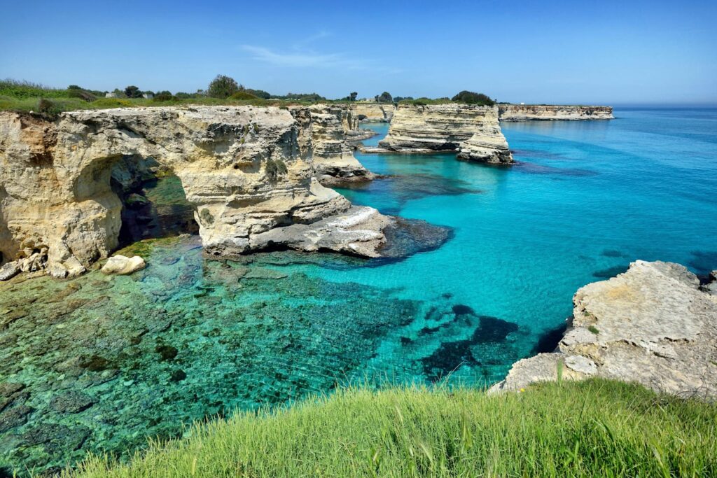
There is something very simple about this walk: you start in one of Italy’s finest baroque cities and you finish where the land runs out. In between are five or six days on foot across the Salento, among dry-stone walls, olive groves, sixteenth-century watchtowers and coves you can swim in at the end of a stage.
Two routes, and only one open
Both start at the same place: Porta Napoli in Lecce, where you get the first stamp in your pilgrim credential. Then they part.
- The sea route — 115 km, 5 stages. It reaches the Adriatic on the first day, near Roca Vecchia, and never leaves it. This is the one that is open.
- The inland route — 135 km, 6 stages, through the interior. Richer culturally — it crosses the Grecìa Salentina, where an ancient Greek dialect is still spoken — but closed for 2026.
The stages of the sea route
From Lecce to Santa Maria di Leuca in five days along the Adriatic coast. The first day is the longest and the least coastal: you leave the city on country lanes and only reach the sea at Roca Vecchia. From there the Adriatic is almost always in sight.
- Lecce – Roca Vecchia — the longest, mostly inland. If you want to reach the sea sooner you can break it by sleeping at San Foca or Torre dell’Orso.
- Roca Vecchia – Otranto — beaches, Aleppo pine woods and the Grotta della Poesia. Otranto deserves an extra evening.
- Otranto – Santa Cesarea Terme — the coast turns rocky and you pass the Punta Palascìa lighthouse, the easternmost point of Italy.
- Santa Cesarea – Castro Marina — short, with cliffs and sea caves.
- Castro – Marina Serra – Santa Maria di Leuca — the last kilometres to the De Finibus Terrae sanctuary, between two seas.
And here are the numbers, taken from the GPS track: 112.5 kilometres from Lecce to Santa Maria di Leuca, and the real length of each day. The first stage is by far the longest — it is the one that sets the rhythm of everything that follows.
GPS track — the sea route (Lecce → Leuca)
Km between stages
The stages of the sea route
| Stage | From → to | Stage km | Cumulative km |
|---|---|---|---|
| 1 | Lecce → Roca Vecchia | 27.6 km | 27.6 |
| 2 | Roca Vecchia → Torre dell’Orso | 4.1 km | 31.7 |
| 3 | Torre dell’Orso → Otranto | 16.7 km | 48.4 |
| 4 | Otranto → Santa Cesarea Terme | 21.8 km | 70.2 |
| 5 | Santa Cesarea Terme → Castro Marina | 8.2 km | 78.4 |
| 6 | Castro Marina → Marina Serra | 13.9 km | 92.3 |
| 7 | Marina Serra → Santa Maria di Leuca | 20.2 km | 112.5 |
The real difficulty, which is not the one you expect
No mountains, almost no serious climbing. And yet many walkers find it harder than they expected, for three reasons that have nothing to do with your legs.
- The sun. Shade is scarce: olive trees don’t make any and neither do dry-stone walls. That is why the right season is spring or autumn, never July and August.
- The wind. On the Adriatic coast it often blows head-on, and eight hours against the wind tire you more than a hill.
- The tarmac. Part of the route follows minor roads: those are hard kilometres on the feet, and good shoes matter more here than on a dirt path.
What to know before you go
The route is waymarked with orange arrows, but the official site still recommends carrying the GPS track: it is sent free of charge when you fill in a form, and the date of the last update is stated. Download the map for offline use and bring a power bank.
There is a pilgrim passport to be stamped along the way, which also gives access to affiliated accommodation. It is not compulsory, but it gives the day a rhythm — and if a stamp point is closed, note the place and walk on: the point is to walk, not to collect.
And it is not the only walking route in Puglia
The Via Francigena del Sud also runs from Lecce to Leuca, inland via Martano: same start, same finish, two different routes and two different waymarkings. Further north there are the Cammino Materano, whose Via Peuceta leaves from the basilica of San Nicola in Bari and reaches Matera in seven stages, and the Via Micaelica, the Lombard pilgrims’ route up to the sanctuary of Saint Michael on the Gargano.
Together, the Via Francigena and its three branches account for 878 kilometres across Puglia in 42 stages, which we measured one by one from the official tracks — including the climb, which almost nobody publishes.
The walk ends at Santa Maria di Leuca, the southernmost point of the heel — a place worth a day of its own once the walking is done.