The Via Francigena del Sud, the southern Via Francigena, crosses Puglia for 878 kilometres in 42 stages, measured one by one on the official GPS tracks: a main route of 554 km from the Monti Dauni to Santa Maria di Leuca, plus three variants, the Litoranea along the Adriatic, the Micaelica to Monte Sant’Angelo and the Bradanica towards Matera. For long stretches the path follows the Roman Via Traiana, a UNESCO World Heritage Site since 2024. And the bid for the Italian Via Francigena itself to become a World Heritage Site is due to be decided in the autumn of 2026.
Where it enters Puglia, and where it ends
The Via Francigena is not a single road. It is the name given to the bundle of routes that pilgrims followed from northern Europe down to Rome, and from there on to the ports where they took ship for the Holy Land. Its southern branch, the Via Francigena del Sud, enters Puglia from the Apennines of Campania, comes down onto the Tavoliere plain and then runs along the Adriatic to Santa Maria di Leuca, the de finibus terrae: the end of the land.
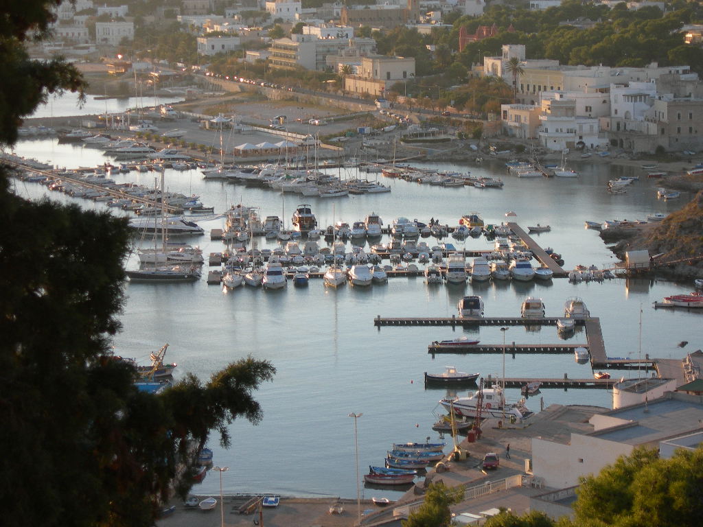
The first stage to reach Apulian soil ends at Celle di San Vito, the smallest municipality in Puglia, up in the Monti Dauni hills. From there the path goes down to Troia, crosses the Tavoliere through Ordona, Stornara and Cerignola, touches Canosa, Andria and the Murgia upland, reaches Bari and from there follows the coast to Brindisi, then turns inland towards Lecce and heads down to the very tip of the heel of Italy.
The four branches, in kilometres and in effort
We calculated these figures ourselves, stage by stage, from the GPS tracks published by the European Association of the Vie Francigene (AEVF). The climb in particular is hard to find almost anywhere else, and it is what separates an easy day from a hard one.
- Main route: 25 stages, 554 km, +4,628 metres of climbing. From Celle di San Vito to Santa Maria di Leuca.
- Litoranea variant: 9 stages, 144 km, +1,029 metres. From Monte Sant’Angelo to Bari along the Adriatic coast.
- Micaelica variant: 5 stages, 114 km, +2,007 metres. From Troia to the sanctuary of Monte Sant’Angelo.
- Bradanica variant: in Puglia, 3 stages and 66 km, from Ordona to Ascoli Satriano and Candela; then the path moves into Basilicata.
A check worth telling. Once we had worked out our figures, we compared them with those published by the Puglia Region. For the Litoranea the Region gives 143.8 kilometres and our measurement gives 143.7: a tenth of a kilometre apart over a hundred and forty. For the whole Bradanica, 217.8 against 218.8. Two independent measurements that agree are not absolute proof, but they are far better than a single number.
The profile of the main route: 554 kilometres from the Monti Dauni to Santa Maria di Leuca, with the twenty-five stages marked and numbered every five. The shape of the walk is clear at a glance: the hard work is all at the start, in the Daunian Apennines, and then Puglia flattens out and for four hundred kilometres there is almost no climbing at all.
The stages worth knowing about before you go
- The longest is Torre Santa Sabina to Brindisi, 34.7 km: almost all along the coast, but a full day.
- The shortest is Molfetta to Giovinazzo, 8.1 km, a morning’s walk that can be combined with the next stage.
- The toughest on the main route is the one that brings you into the region, Buonalbergo to Celle di San Vito, 29.3 km with 973 metres of climbing: it starts in Campania and ends in the Monti Dauni. Of the stages entirely in Puglia, the hardest is Celle di San Vito to Troia, 17.1 km with 360 metres up and 641 down.
- The five stages of the Salento, Lecce, Martano, Otranto, Vignacastrisi, Tricase, Leuca, add up to 118.9 km by our measurement.
Every stage, one by one
Distance and climb measured by us on the AEVF tracks, stage by stage. The climb given is the total ascent, the number that tells a long day from a hard one: they are two different things, and usually you only find one of them quoted.
There are thirty-seven here, and it is fair to say so: below are the main route and two of the variants. The five stages of the Micaelica, from Troia to Monte Sant’Angelo, are not listed on this page; added to these they make the forty-two stages and 878 kilometres.
The main route, from the Monti Dauni to Leuca
- 1. Buonalbergo – Celle San Vito: 29.3 km, +973 m. It starts in Campania: this is the stage that enters Puglia, and all of it counts in the 554 kilometres.
- 2. Celle San Vito – Troia: 17.1 km, +360 m
- 3. Troia – Castelluccio dei Sauri: 23.7 km, +194 m
- 4. Castelluccio dei Sauri – Ordona: 19.9 km, +158 m
- 5. Ordona – Stornara: 20.3 km, +152 m
- 6. Stornara – Cerignola: 17.9 km, +93 m
- 7. Cerignola – Canosa: 19.2 km, +91 m
- 8. Canosa – Andria: 24.1 km, +318 m
- 9. Andria – Corato: 14.2 km, +117 m
- 10. Corato – Ruvo di Puglia: 12.2 km, +127 m
- 11. Ruvo di Puglia – Bitonto: 18.4 km, +20 m
- 12. Bitonto – Bari: 23.2 km, +53 m
- 13. Bari – Mola di Bari: 23.5 km, +100 m
- 14. Mola di Bari – Monopoli: 29.1 km, +279 m
- 15. Monopoli – Savelletri: 21.8 km, +156 m
- 16. Savelletri – Torre Canne: 8.9 km, +30 m. The shortest on the main route, easily combined with the next one.
- 17. Torre Canne – Torre Santa Sabina: 30.0 km, +113 m
- 18. Torre Santa Sabina – Brindisi: 34.7 km, +155 m. The longest of all.
- 19. Brindisi – Torchiarolo: 25.2 km, +175 m
- 20. Torchiarolo – Lecce: 22.5 km, +127 m
- 21. Lecce – Martano: 30.9 km, +162 m
- 22. Martano – Otranto: 30.5 km, +204 m
- 23. Otranto – Vignacastrisi: 25.9 km, +251 m
- 24. Vignacastrisi – Tricase: 13.6 km, +106 m
- 25. Tricase – Leuca: 18.0 km, +114 m. The finish, at the tip of the heel.
The Litoranea variant, from Monte Sant’Angelo to Bari
The profile of the Litoranea. The descent at the start is the one from Monte Sant’Angelo down to the sea: eight hundred metres lost in thirteen kilometres, and the only demanding part of the whole variant. From there on you walk along the edge of the coast.
- 1. Monte Sant’Angelo – Manfredonia: 13.9 km, +178 m
- 2. Manfredonia – Zapponeta: 27.4 km, +193 m
- 3. Zapponeta – Margherita di Savoia: 19.0 km, +81 m
- 4. Margherita di Savoia – Barletta: 16.4 km, +75 m
- 5. Barletta – Trani: 14.3 km, +108 m
- 6. Trani – Bisceglie: 10.9 km, +111 m
- 7. Bisceglie – Molfetta: 12.0 km, +72 m
- 8. Molfetta – Giovinazzo: 8.1 km, +64 m. The shortest stage of the whole Francigena in Puglia.
- 9. Giovinazzo – Bari: 21.7 km, +147 m
The Bradanica variant, the Apulian stretch
The profile of the three Apulian stages of the Bradanica, which then continues into Basilicata. Sixty-six kilometres with 2,252 metres of climbing: in proportion to the distance, the most strenuous stretch of the whole Francigena in Puglia, almost thirty-four metres of climb per kilometre, against eight on the main route.
- 1. Ordona – Ascoli Satriano: 19.3 km, +550 m
- 2. Ascoli Satriano – Candela: 19.1 km, +559 m
- 3. Candela – Melfi: 27.6 km, +1,144 m. It leaves Puglia, as Melfi is in Basilicata, and it is also the hardest of the three.
An accessible Salento: the Ministry project
In August 2026 the Italian Ministry of Tourism announced funding for a project called “For a Via Francigena del Sud accessible to all”, led by the town of Poggiardo together with the European Association of the Vie Francigene and the association Mollare Mai.
It covers about 120 kilometres and five stages between Lecce and Santa Maria di Leuca, exactly the stretch that our measurement puts at 118.9 km, with work in the towns of Poggiardo, Cannole, Giuggianello, Giurdignano, Martano, Palmariggi and Tricase. The idea of accessibility is a broad one: not only motor, sensory and cognitive disabilities, but also needs linked to age, diet and temporary conditions.
Underfoot, a Roman road that is a World Heritage Site
Between Bari and Brindisi the Via Francigena del Sud does not invent a route: for much of the way it follows the Via Traiana, the variant of the Via Appia that the emperor Trajan had built at the start of the second century AD to shorten the journey to the port of Brindisi.
This has a precise consequence. On 27 July 2024 UNESCO added to the World Heritage List the site “Via Appia. Regina Viarum”, and that site includes stretches of the Via Traiana as well as the Appian Way itself, across Lazio, Campania, Basilicata and Puglia. Walking from Bari towards Brindisi, at several points you are walking on a World Heritage Site.
The Francigena’s UNESCO bid
There is a second UNESCO question under way, and it concerns the Italian Via Francigena as a whole: its bid to become a World Heritage Site is being assessed, with the outcome expected in the autumn of 2026. If it succeeds, Puglia will be the final stretch of a recognised route, and Santa Maria di Leuca its finishing line.
Two notes on the GPS tracks
The first is about a limit in the data, and we prefer to say so. For two stages, Lucera to San Severo on the Micaelica variant and the Ruvo variant via Terlizzi on the main route, the official track contains no altitude data. For those we do not give a climb: writing “zero metres” would mean they are flat, which is not the same as not knowing.
The second is about how to use them. A GPS track records what one person walked on one day, not a route certified to the centimetre. It is excellent for knowing how far you walk and how much you climb; to find your way on the ground you need the official waymarking and the up-to-date track downloaded from the route’s own website.
The Via Francigena is one of three walking route systems in Puglia, together with the Cammino Materano and the Cammino del Salento: all three, with what is open today, are on our page Puglia on foot.
The other walking and cycling routes of the region are on our page of itineraries in Puglia.