
In Puglia the walking season begins when the beach season ends, in September. That is what the organisations running the routes say, not just us: the reason is the heat, not the hills. We measured 878 kilometres of the Via Francigena in Puglia, 42 stages, with the elevation gain, the figure almost nobody publishes. And we wrote down something most guides leave out: which routes are actually open, because three of them are not.
A season the other way round
In August Puglia is a region of beaches. In September it turns into something else, and this is not brochure talk: it is the month when the inland becomes walkable again. Walkers have always known it, and the organisations behind the Apulian routes all point to the same window. The Cammino Materano recommends spring and autumn for its Via Ellenica, autumn, winter and spring for the Via Peuceta and autumn to spring for the Via Jonica.
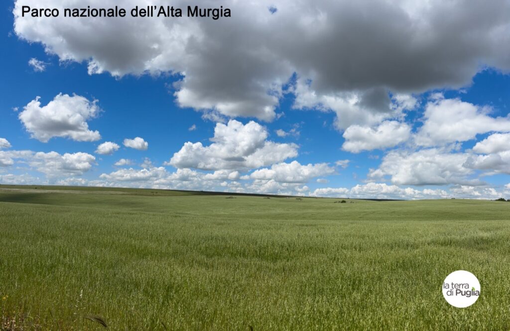
The reason is not effort. Puglia is flat almost everywhere, and the only serious climbs are on the Gargano, the mountainous promontory in the north. The reason is the sun: from June to September the inland regularly goes above thirty-five degrees and shade is rare, because olive groves give little and dry-stone walls none at all. On many stages you walk for hours without a single tree.
From mid-September the days are still long, temperatures have dropped, the villages are pleasant again and there are free beds. It is the same reasoning that applies to cycling in Puglia in September and October, and more generally to why September is the best month to visit.
878 kilometres, measured one by one
The Via Francigena, the great European pilgrim road to Rome, does not end in Rome: its southern branch carries on all the way to Santa Maria di Leuca, where Italy runs out. In Puglia alone there are 42 stages, and we measured them one by one from the tracks published by the European Association of the Via Francigena Ways, the body that manages the route for the Council of Europe.
- 878 kilometres in Puglia
- 42 stages on four branches
- +9,917 metres of elevation gain
- 3 different systems of walking routes
Elevation gain is the point. Everyone publishes the distances; almost nobody publishes the climbing, and it is the climbing that separates an easy day from one that floors you. Two examples speak for themselves. The stage from Stignano to San Giovanni Rotondo is twenty and a half kilometres with 984 metres of ascent; the one from Monte Sant’Angelo to Manfredonia is fourteen kilometres in which you descend 963 metres, from the 818 metres of the sanctuary down to the sea. Two short stages on paper. Not on your legs.
Which ones you can really walk
It is the question that decides a trip, and guides almost always skip it. Puglia has three systems of walking routes: the Via Francigena del Sud, the Cammino Materano with its seven ways, and the Cammino del Salento. Not all of their routes can be walked.
- Open and waymarked: the main trunk of the Via Francigena, the Via Peuceta from Bari, the Via Ellenica from Alberobello, and the Via del Mare of the Cammino del Salento.
- Open, but walk it with a GPS track: the Ellenica variant between Brindisi and Alberobello, where the association itself says the waymarking is patchy.
- Closed: the Via dei Borghi of the Cammino del Salento, closed for 2026 while the route is redrawn, and the Sveva and Dauna ways of the Cammino Materano.
Why we write this. A closed route is not a technicality: it means no arrows at junctions, nobody maintaining the paths, and guesthouses that do not know they are on a route. Guides that list seven ways of the Cammino Materano without saying that two cannot be walked send people the wrong way. Our information was checked in August 2026, but before you set off the last word always belongs to the official website of the route.
From Lecce to Leuca there are two routes, not one
This is the most common mix-up, and it is worth clearing up. The Via Francigena del Sud heads south through Martano, Otranto, Vignacastrisi and Tricase in five stages. The Cammino del Salento, on its Via del Mare, goes through Roca Vecchia, Torre dell’Orso, Otranto, Santa Cesarea, Castro and Marina Serra in five.
Same start, same finish and one shared point at Otranto, but in between they are two different roads, with two sets of waymarks and two pilgrim passports. Walkers who confuse them end up looking for arrows that do not exist on that stretch. Our guide to the Cammino del Salento has its stages in detail.
Where to start
For the landscapes these routes cross, start from the Murgia, the high limestone plateau of the Via Peuceta, and the sanctuary town of Monte Sant’Angelo on the Gargano, where the Via Francigena reaches the sanctuary at 818 metres. All our routes and itineraries are collected in the Itineraries section.
One last thing, and it is the most useful advice of all: look at the elevation gain, not the distance. In Puglia two stages of the same length can be two completely different days, and now the number is there, stage by stage.




You must be logged in to post a comment Login