The Micaelica variant of the Via Francigena climbs from Troia to Monte Sant’Angelo in five stages and 114 kilometres, ending at the sanctuary of Saint Michael the Archangel on the Gargano: the oldest pilgrimage destination in Puglia, the one the Lombards reached along the Via Sacra Langobardorum. This is the part of Puglia where you really climb: 2,007 metres of height gain, with one stage of 984 metres uphill and another in which you drop 963 metres down to the sea.
The Archangel’s road
Long before the Via Francigena as we know it existed, people were already climbing the Gargano, the mountainous promontory that juts into the Adriatic from the north of Puglia. The cave where, according to tradition, the Archangel Michael appeared is one of the oldest sanctuaries in Europe, and the road the Lombards, the Germanic people who ruled much of southern Italy in the early Middle Ages, took to reach it had a name of its own: the Via Sacra Langobardorum. The branch that takes walkers up there today is the Micaelica variant, and it begins where the main route of the Francigena crosses the Tavoliere, the great plain of northern Puglia.
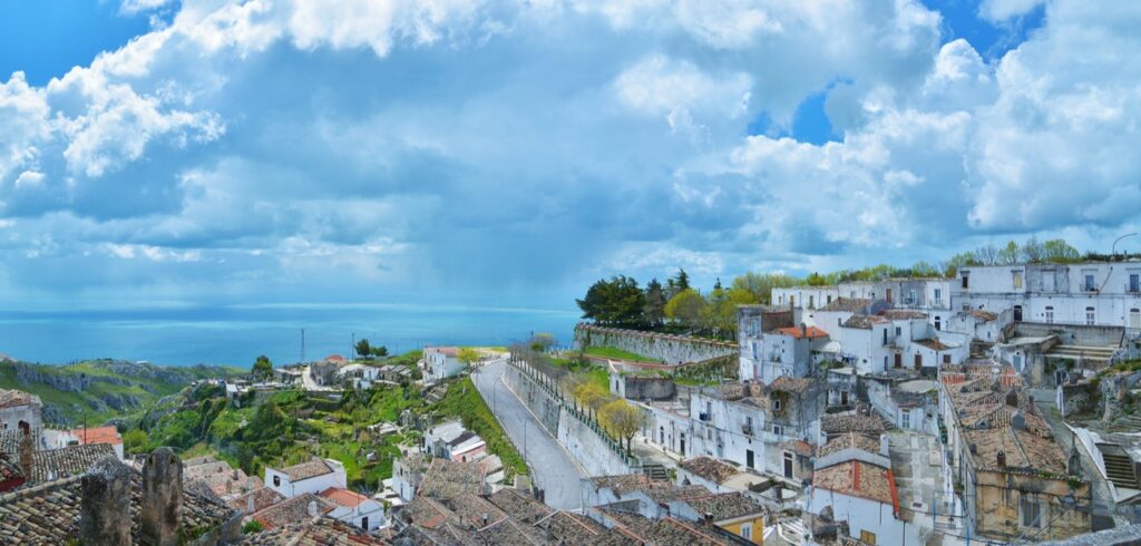
The five stages, and what each one costs
We measured them ourselves on the GPS tracks of the European Association of the Via Francigena Ways. These are five days in which Puglia changes face twice: first the plain, then the mountain.
- Troia to Lucera: 21.8 km, 176 m of climbing and 394 m of descent. You come down from the Daunian Mountains towards the Tavoliere, between Troia and Lucera.
- Lucera to San Severo: 27.2 km, right across the flat plain of the Tavoliere.
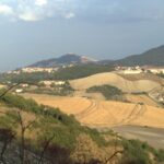
- San Severo to Stignano: 20.0 km, 274 m of climbing. This is where the ascent begins: from around thirty metres above sea level to almost three hundred.
- Stignano to San Giovanni Rotondo: 20.5 km with 984 metres of climbing. It is the hardest of all the stages entirely within Puglia, and in twenty kilometres it takes you up to 934 metres.
- San Giovanni Rotondo to Monte Sant’Angelo: 24.9 km, 573 m of climbing. You walk at altitude, between 463 and 860 metres, and arrive at the sanctuary.
One figure we cannot give you, and we would rather say so. The official track for the Lucera to San Severo stage contains no altitude readings. The file is there, the kilometres are there, the elevation is not. It crosses the Tavoliere and is almost certainly flat, but “almost certainly” is not a number. That is why the total of 2,007 metres for the Micaelica variant is the sum of four stages out of five, not five. Writing “zero metres” on that line would have been convenient, and false.
The descent nobody expects
If you carry on past the sanctuary along the Coastal variant towards Bari, you immediately meet the most unusual stage of the whole system: Monte Sant’Angelo to Manfredonia, just 13.9 kilometres in which you lose 963 metres of altitude. You start at 818 metres and finish by the sea.
On paper it is a short stage, the kind you look at and think “half a day”. In reality it is a continuous descent of almost a thousand metres, which is harder on the knees than an equivalent climb. There is also a historic variant of the same stretch, practically identical in length and drop.
San Giovanni Rotondo, which is another matter
San Giovanni Rotondo is the second-to-last stage of the Micaelica, and it is also one of the busiest pilgrimage destinations in southern Italy in its own right, because of Padre Pio, the Capuchin friar and saint who lived there. Walkers arrive on foot after the hardest day of the route; the great majority of visitors arrive by coach. They are two very different experiences of the same place, and walkers should know it beforehand: in the peak pilgrimage season the town is crowded, and it is wise to book.
Why the Gargano is a case apart. The rest of Puglia is flat: the main route of the Francigena, over 554 kilometres, adds up to 4,628 metres of height gain. The Micaelica variant adds up to 2,007 in just 114. In other words, in an eighth of the distance you climb almost half as much. Anyone who reaches the Gargano with legs used to the Tavoliere notices it at the first bend above Stignano.
How it fits with the rest
The Micaelica leaves the main route at Troia and rejoins it at Bari, by way of the coast: you can climb to the sanctuary and then come down along the Adriatic through Barletta, Trani, Bisceglie, Molfetta and Giovinazzo, picking up the main route again at Bari. That is another 144 kilometres, almost all of them flat.
The full picture of the Francigena in Puglia, and the other walking routes of the region, are in our page on walking in Puglia. All our routes through the region are collected under Itineraries.